

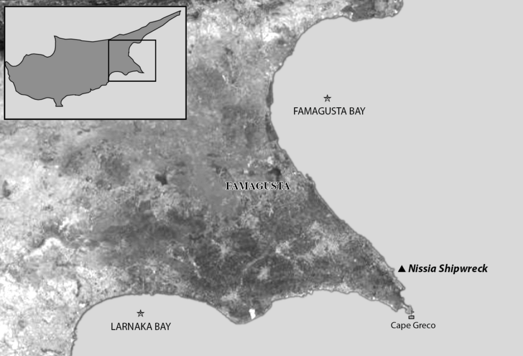
The Protaras coast, Paralimni, is one of the most developed coasts of the island. The area attracts a lot of tourism and has a heavy diving industry. The shipwreck of Nissia, Famagusta Bay, Cyprus, lies at a depth of 27 metres. It was known to the local diving community since the 1980s, but it was not officially reported to the authorities until 1992. Due to its location, at a depth easily accessible to divers, it was transformed into an uncontrolled spot for recreational diving, which resulted in the destruction of valuable archaeological evidence.
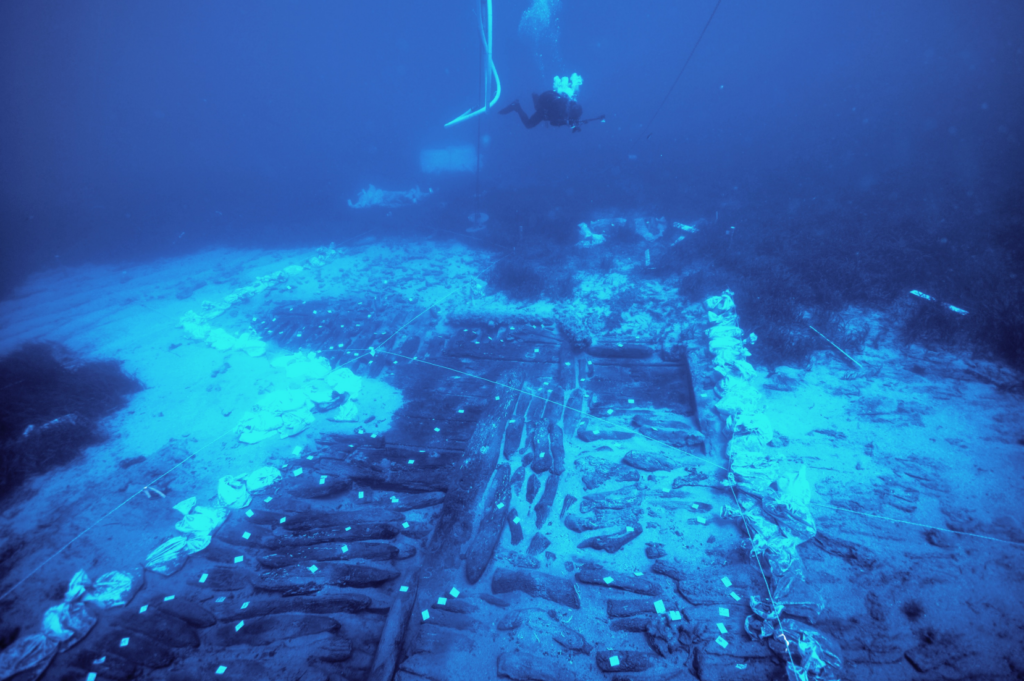
Since 2014, an investigation is in progress, led by a team from the Maritime Archaeological Research Laboratory (MARELab) of the University of Cyprus. Although many aspects of the ship’s history remain unknown, such as its function and type, some light has been shed on this enigmatic wreck: it is dated to the 18th century and a good part of its wooden hull is still preserved, buried under the sand.
As the Nissia is the only known shipwreck of this period in Cyprus and one of the few to have been excavated in the eastern Mediterranean, its study is expected to make a significant contribution to the maritime history and shipbuilding traditions of the eastern Mediterranean.
Underwater sites, such as shipwrecks, have the potential to provide new and exciting information about the human past. It is imperative that we treat underwater cultural heritage with great care, adhering to principles that advocate preservation, minimal disturbance unless for scientific reasons, and prevention of looting to ensure the protection of our maritime heritage.
An in-situ preservation strategy has been set in motion at the Nissia shipwreck: the site is backfilled and covered for protection reasons. As the remains become invisible for visitors, data analysis is in progress which yields precious pieces of information about the site. This dynamic application functions as a digital info point, through which the main research results and the interventions at the site are shared with the public.
As the marine environment significantly influences the rate of decay, the state of artefacts, and the overall integrity of a site, understanding the surrounding ecosystem becomes essential for implementing effective conservation and management strategies, ensuring the continued protection and study of our maritime heritage. For this reason, the Nissia Shipwreck is one of the seven pilot sites participating in the European programme THETIDA, under the framework of the “Heritage 01-08-Effects of climate change and natural hazards” call. The programme’s objective is the study of sustainable methods for protecting coastal and underwater cultural heritage from the impacts of climate change, natural hazards, and environmental pollution and will focus on developing tools that will support efforts in the protection and management of such sites.
The THETIDA project will employ a multi-faceted approach, combining scientific research, technological innovation, and community engagement, to dynamically respond to these environmental shifts, ensuring a resilient and sustainable preservation approach. A specialized electronic buoy will be developed and deployed to remotely monitor the environmental conditions surrounding the Nissia shipwreck. Active community engagement is also a key objective, aiming to raise public awareness on issues related to the protection of the shipwreck. Furthermore, by involving non-professionals in the data collection process, through citizen science, the project aims to foster a sense of shared responsibility and encourage a deeper connection to maritime heritage. This approach aims to address the challenges posed by climate change and natural hazards, ensuring a thorough understanding of the site’s conditions and facilitating the implementation of targeted protective measures.
Software
The photogrammetric models used in the DMA were decimated in Meshlab. Adobe Illustrator was used for annotating the Nissia site plan. All 3D scenes and exported .gltf files were created using Autodesk Maya and the Verge 3D plugin. Verge 3D and Adobe Dreamweaver were used in tandem to create the final interactive application.
Given Verge3D’s reliance on WebGL for rendering 3D graphics within web browsers, we highly recommend using Google Chrome for the best viewing experience when interacting with Mare Cyprium’s 3D web applications.
Further reading
Useful links
The Ultima Ratio Project: a database of historical muzzle-loading artillery guns.
The Thetida Project.